In the previous articles on world building we’ve looked at the island and city of Art, along with the cathedral complex and cradle gardens. Here I want to share the ideas behind the world map that I created.
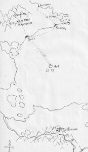
This is the earliest of the maps of Gear that I had drawn, and it’s fair to say I started off thinking too small. I’ve marked the route Keyanna took from the Hammarot mountains to Forseea, via Salis, Kloma, and Lama. At the bottom of the map I detailed the temple of Amoonsher and lake Aerun, as I had plans for these locations.
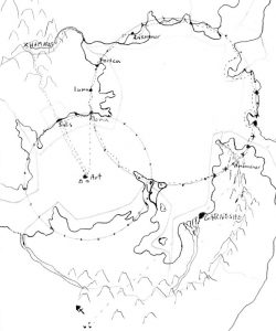
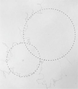
The second map shows my ideas when I expanded my world map and added the concept of the circular Onorail systems. I had added Anthamer, the port city where Keyanna spent some time waiting for favourable winds. Along with the capital city of Garnet, which is called Garneshe. It’s clear to see the similarities between the first and second map in the upper sections. The second map is very rough and obviously a work in progress, as you can see where I have added on more land, to make Keyanna’s reasoning for buying a horse more viable, rather than hiring a ship to take her all the way.
This map is starting to show more resemblance to my final map, as the second Onorail system is significantly larger than the first. I still had the same problems with this map as the previous ones, there were too many terminals on sea platforms or close enough to the coast, that a boat with be the easiest form of transport. One of the notable changes on this map is the impact crater between Salis and Solis, as by this point, I had come up with the Arten arrival story, and the destruction of the ancient city of Peeves.
Up to this point I had been making up the map as I had gone along, trying to build a world to fit around the places that I was creating, rather than creating a world and populating it with places afterwards. I made a significant alteration to my method after this, which led to the creation of a vast world map, which we will be looking at in a future article on world building.