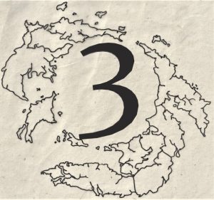
The island of Art
The main island shares the name of the capital city of the Arten’s, both are called Art, I’m normally fairly creative when it comes to naming places, but in this instance I went with a simple name and it stuck. When I was writing the introduction for the second book “Journeys”, I joked that Artens were great scientists and engineers, but they just weren’t very imaginative when it came to naming anywhere or anything.
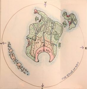
As you can see in this early map, I seemed determined on that day to give everything three letter names. Whilst the shared name for the capital city and the main island stuck, I’ve never refered to any of the smaller towns or islands by the names shown, if at all.
At some point between this sketch and my final design I rotated the island by 90°, so the city faces east instead of south and the reef has gone altogether. In my final designs there are three islands with Art being the largest, but surprisingly little else has changed from my early concepts.

As you can see in this second island map, I have expanded the range of the protective shield, called ‘The Edge of Art’ to completely cover all the little islands. This was my original intent, but as the first drawing was in my sketchbook there wasn’t room. Also, in my second sketch I’ve made the dockside more detailed and I have highlighted the twin lighthouses in red.
The city of Art
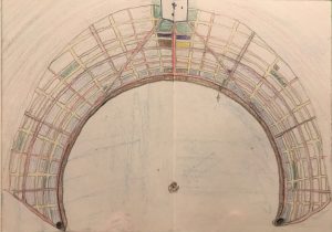
As I’ve already mentioned the city and the island have rotated 90°, but the general layout of the city has stayed the same. As Artens work on logic, it made sense to put the city on a grid basis, with the bay forming the shape of a crescent moon, it made sense to radiate the streets from that curve. The perfect shape of the bay was not a natural phenomenon, but I will explain that in more detail in another article. In this sketch I tried to identify main thoroughfares in red, secondary roads in orange and smaller streets in yellow.
The main street, which falls down the centre of the notebook page, is called Central Avenue, the curved street indicated in red about halfway through the city is called Broadway. At either end of Broadway, on opposite sides of the bay are the North and South barracks. The North barracks is headquarters for the sky division, and the South barracks is where the Navy administration buildings are located. Homeland defence is located within the cathedral complex.
The large rock in the centre of the bay was supposed to be a pedestal for a large and impressive monument. I could never decide exactly what kind of monument would be right for that spot, so I left it empty. The empty pedestal can be just as interesting as a monument that had been built, I like to imagine the Arten council arguing over what kind of monument to build and never reaching a decision.
In later changes to the city map, the cathedral complex was pushed further west beyond the city boundaries, I like the idea of it being separated by a small stretch of woodland. I also chose to add more city parks which are indicated in green, and three market squares.